 2015-08-26 00:38:11 2015-08-26 00:38:11
|
Post #1
沿着梭罗和足迹:鳕鱼角 海洋荒野户外文化瑰宝 |
 kurtyang04 kurtyang04
|
沿着梭罗和足迹:鳕鱼角 海洋荒野户外文化瑰宝 Cape Cod is the bared and bended arm of Massachusetts: the shoulder is at Buzzard's Bay; the elbow, or crazy-bone, at Cape Mallebarre; the wrist at Truro; and the sandy fist at Provincetown,—behind which the State stands on her guard, with her back to the Green Mountains, and her feet planted on the floor of the ocean, like an athlete protecting her Bay,—boxing with northeast storms, and, ever and anon, heaving up her Atlantic adversary from the lap of earth,—ready to thrust forward her other fist, which keeps guard the while upon her breast at Cape Ann. "A hundred years of warring with the gales and the breakers, a hundred years of struggle with the tides have passed over the rampart wall and made their natural changes, but it still fronts the unappeased, insatiable sea with an earthly strength of sand itself taken from the waves. The volutes of the breakers approach, tumble, and dissolve, and over the glisten, the foam, and moist, sea-fragrant air still fly the small shorebirds hastening. A noble world, and one is glad that it once touched the imagination of the obstinate and unique genius from whom stems the great tradition of nature writing in America." - Henry Beston, 1951 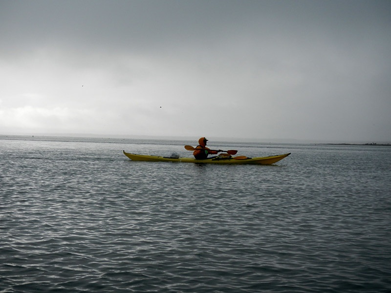 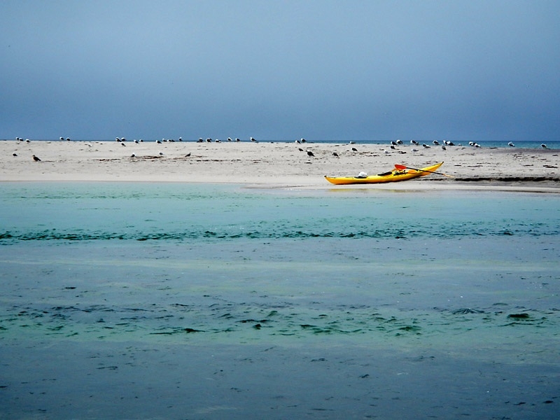 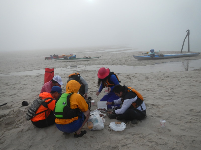 所有照片来自2015/8月的一次活动 在北美,户外一个重要概念叫Wilderness 维基: Wilderness or wildland is a natural environment on Earth that has not been significantly modified by civilized human activity. It may also be defined as: "The most intact, undisturbed wild natural areas left on our planet—those last truly wild places that humans do not control and have not developed with roads, pipelines or other industrial infrastructure." 原野或作原野芳华[來源請求],原野芳华是地球上尚未受到大規模人類活動改造的自然地帶。它也可以被定義為:「最完好也最未受干擾,不受人類的控制、道路或管線的開發,與工業設施入侵的自然地帶。 [1]」原野地帶往往受到人類保護,因其往往是珍貴物種的棲地,或具有獨特的自然景觀與豐富的物種多樣性,而這些都是難以在都市、實驗室或動物園內重現的。原野也常保存人類最初始的文化遺蹟、精神與審美觀。 国家地理知识 堰洲島沙丘,湿地,海豹,鲸鱼 海洋舟北美特色 北美海洋舟名地之四:鳕鱼角- 美国加拿大波士顿  1 2 1 2
|
|
kurtyang04 于 2018-11-01 06:13:43 编辑
|
|
 2015-08-26 00:59:32 2015-08-26 00:59:32
|
Post #2
Re: 户外瑰宝北美概念之一Wilderness原生态: 背包客水上运 ... |
 kurtyang04 kurtyang04
|
原野 的一些特点, "往往是珍貴物種的棲地,或具有獨特的自然景觀與豐富的物種多樣性" 原野也常保存人類最初始的文化遺蹟、精神與審美觀 原野(原生态)的探索主要有两种形式:背包客,海洋或河流皮划艇的旅行探索。 原生态户外在北美户外占极其重要地位, 是高质量户外活动来源,是户外爱好者的理想动力源泉, 也是北美户外商业收入重要来源。 背包客在国内发展相当成熟,而海洋或河流皮划艇的原生态旅行探索, 落后不是一步俩步,可以说还在相当初级阶段。 用一个我们北美当地华人的海洋原生态活动, 来分析这种水上原生态活动的特点和特色。 |
 2015-08-26 04:18:22 2015-08-26 04:18:22
|
Post #3
Re: 户外瑰宝北美概念之一Wilderness: 水上运动背包客翻版 ... |
 kurtyang04 kurtyang04
|
先比较 双胞胎 背包客和原生态皮划艇旅行的相同点和不同点: 相同点: 原生态路线,带着帐篷去旅行,拖着食品和其他生活用品进山或下海, 对器材有体积和重量要求 不同点: 1, 背包客看到的是山,河流皮划艇是山和水的结合,海洋皮划艇是海岸线和海洋 2, 由于人们视野习惯爬山,加上自驾和自行车,滑雪类似风景,总的来讲,河流皮划艇的角度比较独到,海洋因为人生活在陆地上, 而景观很别致,完全不同于人们习惯的山景风光。 3, 河流皮划艇或漂流能带的物品最多,海洋能带的物品重量或体积也不少,可以是背包族2-3倍 4, 皮划艇需要强大的硬件 -- 皮划艇,运输也是麻烦事,但是作为人类文明的一大发明,皮划艇虽小,带给你的世界很大 5, 背包族对体力要求很高,一般人承受不了。皮划艇旅行体力要求中等,面向的观众更广谱 6, 相对背包族的苦逼生活,皮划艇更多的腐败和闲情逸志的生活 7, 露营都很赞,背包客是美丽的山景,河流皮划艇是倚山傍水,海洋多是沙滩海景 8, 生活用水是一个重要议题,河流皮划艇最舒适,背包客和海洋皮划艇各有各的问题 9, 安全, 背包客相对不大容易失控, 出了错有不少机会可调整。 皮划艇则是问题不少,河流皮划艇难度主要要看激流,一个失误可能损失生活的补给。海洋变幻莫测需要强大的海洋经验。正是皮划艇的安全问题和复杂性,才产生了北美的皮划艇向导这个行业。而背包客在北美基本是AA制活动,几乎没有专业向导。 10, 皮划艇用防水包取代了背包 |
 2015-08-26 12:20:53 2015-08-26 12:20:53
|
Post #4
Re: 户外瑰宝北美概念之一Wilderness: 水上运动与背包客比 ... |
 爵士冰 爵士冰
|
“水上旅行”我喜欢这个概念! |
 2015-08-26 22:16:37 2015-08-26 22:16:37
|
Post #5
Re: 户外瑰宝北美概念之一Wilderness: 水上运动 ... |
 kurtyang04 kurtyang04
|
美国原生态陆地的来源是国家公园,国家森林,国家土地管理局,还有其他自然保护区。 List of largest wilderness areas in the United States From Wikipedia, the free encyclopedia This is a list of the largest wilderness areas in the National Wilderness Preservation System of the United States. It includes all that are larger than 50,000 acres (200 km²). Statistics are as retrieved in September 2009 from Wilderness.net website.[1] Where instances of multiple states or agencies occur, they are listed in descending order of included acreage. The last column lists the entities that the wilderness is entirely (in most cases) part of, or partially included in (minority of cases, usually involving parts of the wilderness that are in otherwise unnamed BLM lands). They are also listed in descending order of included acreage. Agency abbreviations: BLM = Bureau of Land Management; FS = Forest Service; FWS = Fish and Wildlife Service; NPS = National Park Service. Name of Wilderness State(s) Acreage Area: km² Agency / Agencies Located entirely or partly inWrangell-Saint Elias Wilderness Alaska 9,078,675 36,740.1 NPS Wrangell-St. Elias National Park Mollie Beattie Wilderness Alaska 8,000,000 32,374.9 FWS Arctic National Wildlife Refuge Gates of the Arctic Wilderness Alaska 7,167,192 29,004.6 NPS Gates of the Arctic National Park Noatak Wilderness Alaska 5,765,427 23,331.9 NPS Noatak National Preserve Katmai Wilderness Alaska 3,384,358 13,696.0 NPS Katmai National Park Death Valley Wilderness California / Nevada 3,099,770 12,544.3 NPS Death Valley National Park Glacier Bay Wilderness Alaska 2,664,876 10,784.4 NPS Glacier Bay National Park Lake Clark Wilderness Alaska 2,619,550 10,600.9 NPS Lake Clark National Park Frank Church-River of No Return Wilderness Idaho 2,366,757 9,577.9 FS / BLM Payette National Forest / Challis National Forest / Salmon National Forest / Boise National Forest / Bitterroot National Forest / Nez Perce National Forest Togiak Wilderness Alaska 2,274,066 9,202.8 FWS Togiak National Wildlife Refuge |
 2015-08-26 22:29:45 2015-08-26 22:29:45
|
Post #7
Re: 户外瑰宝北美概念之一Wilderness: 水上运动与背包客比 ... |
 kurtyang04 kurtyang04
|
而美国几乎所有原生态的背包客活动, 河流皮划艇漂流发生在200个国家原生态自然保护区。 有人要问,那海洋呢? 人烟罕至的海岸线和海域,无人岛,都算是海洋原生态的一部分,它的定义比较模糊,是陆地国家原生态自然保护区之外, 又一区域非常广阔,户外的天堂。加拿大有几十万公里海岸线,美国在5-10万公里之间。 中国的陆地开发得比较完整,而海洋户外资源开发地不多。 |
|
kurtyang04 于 2015-08-27 06:04:42 编辑
|
|
 2015-08-26 22:34:06 2015-08-26 22:34:06
|
Post #8
Re: 户外瑰宝北美概念之一Wilderness: 水上运动 ... |
 kurtyang04 kurtyang04
|
爵士冰 wrote: “水上旅行”我喜欢这个概念! 读者:爵士冰大侠正是国内原生态河流漂流的掌门人。 |
 2015-08-27 06:22:11 2015-08-27 06:22:11
|
Post #9
Re: 户外瑰宝北美概念 Wilderness: 背包客与独木舟露营比较 ... |
 kurtyang04 kurtyang04
|
背包客与原生态皮划艇旅行的精神是一样的,就是远离嘈杂的人群和邪恶的城市,寻找桃花源,那种与世无争,恍如隔世,唯有山野河流或海洋,以及与无约束下的动物为伴那种感觉。 有些地方,驴子游客太多,本来给你清静感觉没了,也就失去了那种价值和元素。 有些地方, 有些时候, 游客走了,只剩下天空和自己(小伙伴),那种原生态感觉又回来了。 |
 2015-08-27 06:42:51 2015-08-27 06:42:51
|
Post #10
Re: 户外瑰宝北美概念 Wilderness: 背包客与独木舟露营比较 ... |
 kurtyang04 kurtyang04
|
上星期CAPE COD 活动是我们大集体,今年第一次Wilderness 活动,也是为明年极地大型原生态海洋旅行的操练。 参加训练的同学绝大多数,并没有背包客的经历,也不明白什么是wilderness. 听说要露营,好些小伙伴认为与平时的露营没啥区别,纷纷想逃课,有的说是不是能早上出发,傍晚就回去。我真地生气骂娘了,这是训练你带着生活物资去小岛,感受原野的荒凉和艰辛,强势否认了他们那种不敬业精神,于是没有人再说什么。 在这种氛围下,我也不指望太多东西,能把WILDERNESS经验练出来,我就知足。不妙的事继续,天气预报连续3天下中雨(断断续续那种),我能取消吗?极地条件比这更恶劣。 选择地方倒是人烟罕至的国家自然保护区, 非船不能达之处,这一下挡住人群,外加禁止机动船,风景也不错,蛮理想原生态地方。不过天气不好,我就没啥期待。 |
 2016-03-10 17:22:44 2016-03-10 17:22:44
|
Post #11
Re: 户外瑰宝北美概念 Wilderness: 背包客与独木 ... |
 重在掺合彭大熊 重在掺合彭大熊
|
喜欢楼主写的这些材料,尤其是安全方面的案例与说明,我是一个初学的菜鸟,希望在楼主这里学到更多知识
|
|
---------------------------------------- |
|
 2016-03-10 21:11:16 2016-03-10 21:11:16
|
Post #12
Re: 户外瑰宝北美概念 Wilderness: 背包客与独木 ... |
 杜汗 杜汗
|
好文章,水上运动还是小众,就是因为大众的了解不足,或者是独木舟的“门槛太高”,但是很奇怪,好多人到了国外体验了独木舟,如帕劳、菲律宾、马来西亚、泰国、斯里兰卡、尼泊尔,感受到独木舟的好玩,回来才找我们玩,这是中国人户外的崇洋媚外吗?可能是,也可能不是,独木舟在香港台湾都已经开展得很好了,很平民化,独木舟的好玩之处其实只要你试试就知道,无须我们大费口舌,但是中国人祖训的一句话:欺山莫欺水,一下子就吓跑了90%的人,一家人出去玩看见了独木舟,后生的想玩玩可能被长辈一句欺山莫欺水就没有了热情,其实不要说大自然瑰宝的国家公园或者什么名山大川,就是一个宁静无人的水库,让你伸手就可触摸到水,让你看水天一色,让你划破镜面,水上轻盈的飞,就已经很容易打动人了。 所以我觉得,独木舟不需要太过标新立异,不需要登峰造极,不需要神一级的人物,只要平民化,只要大家易于接受,我们就应该从这里开始,我是静水玩家,我想,毋庸置疑静水独木舟的发展才是独木舟运动推广的大舞台,独木舟活动的见报率必须高才可以慢慢消灭欺山莫欺水的祖训。所以我请版主把这些好文章都转到各地板块去,广州版特别需要。 户外装备,独木舟当然是难以运输存放的,但划艇是其他装备就可以很轻松很FB,版主归纳得没有错。 |
|
---------------------------------------- |
|
 2016-03-11 09:21:25 2016-03-11 09:21:25
|
Post #13
Re: 户外瑰宝北美概念 Wilderness: 背包客与独木 ... |
 向工 向工
|
杜汗 wrote: 好文章,水上运动还是小众,就是因为大众的了解不足,或者是独木舟的“门槛太高”,但是很奇怪,好多人到了国外体验了独木舟,如帕劳、菲律宾、马来西亚、泰国、斯里兰卡、尼泊尔,感受到独木舟的好玩,回来才找我们玩,这是中国人户外的崇洋媚外吗?可能是,也可能不是,独木舟在香港台湾都已经开展得很好了,很平民化,独木舟的好玩之处其实只要你试试就知道,无须我们大费口舌,但是中国人祖训的一句话:欺山莫欺水,一下子就吓跑了90%的人,一家人出去玩看见了独木舟,后生的想玩玩可能被长辈一句欺山莫欺水就没有了热情,其实不要说大自然瑰宝的国家公园或者什么名山大川,就是一个宁静无人的水库,让你伸手就可触摸到水,让你看水天一色,让你划破镜面,水上轻盈的飞,就已经很容易打动人了。 所以我觉得,独木舟不需要太过标新立异,不需要登峰造极,不需要神一级的人物,只要平民化,只要大家易于接受,我们就应该从这里开始,我是静水玩家,我想,毋庸置疑静水独木舟的发展才是独木舟运动推广的大舞台,独木舟活动的见报率必须高才可以慢慢消灭欺山莫欺水的祖训。所以我请版主把这些好文章都转到各地板块去,广州版特别需要。 户外装备,独木舟当然是难以运输存放的,但划艇是其他装备就可以很轻松很FB,版主归纳得没有错。 标新立异和大神高阶的玩法跟平民化不冲突,也是吸引眼球的一种方式,当榜样的作为很高时,水上运动就有了标杆和英雄可崇拜,观赏性高了,见报律就高,把玩性就亲民很多,,, 花式的花哨,激流的激情,静水的闲适,海洋的坦荡,多管齐下,我看要得,,, |
 2018-11-01 03:40:22 2018-11-01 03:40:22
|
Post #14
Re: 户外瑰宝北美概念 Wilderness: 背包客与独木 ... |
 kurtyang04 kurtyang04
|
Cape Cod From Wikipedia, the free encyclopedia  Cape Cod National Seashore  Cape Cod (Barnstable County), in Massachusetts Location Massachusetts, United States Coordinates  41°41′N 70°12′WCoordinates: 41°41′N 70°12′WCoordinates:  41°41′N 70°12′W 41°41′N 70°12′WOffshore water bodies Cape Cod Bay Buzzards Bay Cape Cod Canal Nantucket Sound Elevation 306 ft (93 m) Area 339 sq mi (880 km2)[1] Cape Cod is a geographic cape extending into the Atlantic Ocean from the southeastern corner of mainland Massachusetts, in the northeastern United States. Its historic, maritime character and ample beaches attract heavy tourism during the summer months. As defined by the Cape Cod Commission's enabling legislation, Cape Cod is conterminous with Barnstable County, Massachusetts.[2] It extends from Provincetown in the northeast to Woods Hole in the southwest, and is bordered by Plymouth to the northwest. Since 1914, Cape Cod has been separated from the mainland by the Cape Cod Canal. The canal cuts 7 miles (11 km) roughly across the base of the peninsula, though small portions of the Cape Cod towns of Bourne and Sandwich lie on the mainland side of the canal. Two highway bridges cross the Cape Cod Canal: the Sagamore Bridge and the Bourne Bridge. In addition, the Cape Cod Canal Railroad Bridgecarries railway freight and limited passenger services onto the Cape. Cape territory is divided into 15 towns with many villages. Contents 1Region of Cape Cod and the Islands 2Geography and political divisions 2.1Physical geography and boundaries 2.2Towns and villages 2.3Cape Cod and the Islands 2.4Sections 2.5"Upper" and "Lower" 3Geology 4Climate 5Native population 6History 6.1Discovery by Europeans 6.2Settlement 6.3Modern era Region of Cape Cod and the Islands [edit] Like Cape Cod itself, the islands south of the Cape have evolved from whaling and trading areas to become resort destinations, attracting wealthy families, celebrities, and other tourists. These include the large nearby islands of Nantucket and Martha's Vineyard, which have grown in population by 6.8 percent and 10.3 percent, respectively, between 2000 and 2010 while the year-round population of Barnstable County dropped 3 percent according to the Census.[3] Both islands are also famous summer tourist destinations, commonly accessed by ferry from several locations on the cape. The phrases Cape Cod and the Islands and the Cape and Islands are often used to describe the whole region of Barnstable County, Dukes County (including Martha's Vineyard and the smaller Elizabeth Islands), and Nantucket County. Several small islands right off Cape Cod, including Monomoy Island, Monomoscoy Island, Popponesset Island, and Seconsett Island, are also in Barnstable County. The Forbes family-owned Naushon Island was first purchased by John Murray Forbes. Naushon is one of the Elizabeth Islands, many of which are privately owned. One of the publicly accessible Elizabeths is the southernmost island in the chain, Cuttyhunk, with a year-round population of 52 people. Several prominent families have established compounds or estates on the larger islands, making these islands some of the wealthiest resorts in the Northeast, yet they retain much of the early merchant trading and whaling culture. Cape Cod in particular is a popular retirement area; 27.8% of the population of Barnstable County is 65 years old or older.,[4] and the average age of residents is the highest of any area in New England.[citation needed] By voter registration numbers, Democrats outnumber Republicans by less in the three counties than in the whole of Massachusetts, to varying degrees.[5] The bulk of the land in the area is glacial terminal moraine and represents the southernmost extent of glacial coverage in southeast New England; similar glacial formations make up Long Island in New York and Block Island in Rhode Island.[citation needed] Geography and political divisions[edit] Physical geography and boundaries[edit] The name "Cape Cod", as it was first used in 1602, applied only to the very tip of the peninsula. It remained that way for 125 years, until the "Precinct of Cape Cod" was incorporated as the Town of Provincetown. No longer in "official" use over the ensuing decades, the name came to mean all of the land east of the Manomet and Scusset rivers – essentially along the line that became the Cape Cod Canal. The creation of the canal separated the majority of the peninsula from the mainland. Most agencies, including the Cape Cod Commission and the Federal Emergency Management Agency (FEMA), treat the Cape as an island with regard to disaster preparedness, groundwater management, and the like.[1][6][7]Cape Codders tend to refer to the land on the mainland side of the canal as "off-Cape", though the legal delineation of Cape Cod, coincident to the boundaries of Barnstable County, includes portions of the towns of Bourne and Sandwich that are located north of the canal. Cape Cod Bay lies in between Cape Cod and the mainland – bounded on the north by a horizontal line between Provincetown and Marshfield. North of Cape Cod Bay (and Provincetown) is Massachusetts Bay, which contains the Stellwagen Bank National Marine Sanctuary, located 5 miles (8 km) north of Provincetown. The Atlantic Ocean is to the east of Cape Cod, and to the southwest of the Cape is Buzzards Bay. The Cape Cod Canal, completed in 1916, connects Buzzards Bay to Cape Cod Bay; its creation shortened the trade route between New York and Boston by 62 miles (100 km).[8] Cape Cod extends 65 miles (105 km) into the Atlantic Ocean, with a breadth of between 1–20 miles (1.6–32.2 km), and covers more than 400 miles (640 km) of shoreline.[9] Its elevation ranges from 306 feet (93 m) at its highest point, at the top of Pine Hill, in the Bourne portion of Joint Base Cape Cod, down to sea level. One of the biggest barrier islands in the world, Cape Cod shields much of the Massachusetts coastline from North Atlantic storm waves. This protection erodes the Cape's shoreline at the expense of its cliffs, while protecting towns from Fairhaven to Marshfield. Cape Cod and the Islands are part of a continuous archipelagic region consisting of a thin line of islands stretching west to include Long Island. This region is historically and collectively known by naturalists as the Outer Lands. Towns and villages[edit] Cape Cod incorporates all of Barnstable County, which comprises 15 towns: Bourne, Sandwich, Falmouth, Mashpee, Barnstable, Yarmouth, Harwich, Dennis, Brewster, Chatham, Orleans, Eastham, Wellfleet, Truro, and Provincetown. Each of these towns include a number of villages; see Barnstable County for a complete list. Barnstable, the most populated municipality on Cape Cod, is the only one to have adopted a city form of government, whose legislative body is an elected 13-member council.[10][11] However, like other smaller Massachusetts cities, Barnstable retained its "Town of Barnstable" moniker. All of the other towns elect a 5-member Board of Selectmen as the executive policy-setting board, and utilize Town Meetings as their legislative body.[10] Cape Cod and the Islands[edit] To the south of Cape Cod lie Nantucket Sound; Nantucket and Martha's Vineyard, both large islands; and the mostly privately owned Elizabeth Islands. Sections[edit]  1 2 3 4 5 6 7 8 9 10 11 12 13 14 15 Upper Cape 1 Bourne 2 Falmouth 3 Sandwich 4 Mashpee Mid-Cape 5 Barnstable 6 Yarmouth 7 Dennis Lower Cape 8 Brewster 9 Harwich 10 Chatham Outer Cape (occasionally, Lower Cape) 11 Orleans 12 Eastham 13 Wellfleet 14 Truro 15 Provincetown For most of the 18th, 19th, and 20th centuries, Cape Cod was considered to consist of three sections (see map): The Upper Cape is the part of Cape Cod closest to the mainland, comprising the towns of Bourne, Sandwich, Falmouth, and Mashpee. Falmouth is the home of the famous Woods Hole Oceanographic Institution and Marine Biological Laboratory as well as several other research organizations, and is also the most-used ferry connection to Martha's Vineyard. Falmouth is composed of several separate villages, including East Falmouth, Falmouth Village, Hatchville, North Falmouth, Teaticket, Waquoit, West Falmouth, and Woods Hole, as well as several smaller hamlets that are incorporated into their larger neighbors (e.g., Davisville, Hatchville, Falmouth Heights, Quissett, Sippewissett, and others).[12] Bourne is home to the Massachusetts Maritime Academy, in the village of Buzzards Bay, along the canal, Joint Base Cape Cod, Aptucxet Trading Post,[13] the annual Bourne Scallop Festival in September, and, until 1884, was part of Sandwich. Sandwich, the oldest town on Cape Cod, founded in 1637, is home to the Dexter Grist Mill, the historic Hoxie House, Heritage Museums and Gardens, and the Sandwich Glass Museum. Mashpee, is the home of the Mashpee Wampanoag tribe of Native Americans. The Mid-Cape area includes the towns of Barnstable, Yarmouth and Dennis. The area features many beautiful beaches, including warm-water beaches along Nantucket Sound, e.g., Kalmus Beach in Hyannis, which gets its name from one of the inventors of Technicolor, Herbert Kalmus. This popular windsurfing destination was bequeathed to the town of Barnstable by Dr. Kalmus on condition that it not be developed, possibly one of the first instances of open-space preservation in the US. The Mid-Cape is also the commercial and industrial center of the region. There are seven villages in Barnstable, including Barnstable Village, Centerville, Cotuit, Hyannis, Marstons Mills, Osterville, and West Barnstable, as well as several smaller hamlets that are incorporated into their larger neighbors (e.g. Craigville, Cummaquid, Hyannis Port, Santuit, Wianno, and others).[14] The villages of Yarmouth are South Yarmouth, West Yarmouth and Yarmouth Port. There are five villages in Dennis, including North Dennis, East Dennis, West Dennis, Dennis Port, and South Dennis.[15] The Lower Cape & Outer Cape traditionally includes all of the rest of the Cape, or the towns of Harwich, Brewster, Chatham, Orleans, Eastham, Wellfleet, Truro, and Provincetown. In the present day, the five outermost towns (Provincetown, Truro, Wellfleet, Eastham and Orleans) are more commonly and collectively known as the "Outer Cape". This area is home to the Cape Cod National Seashore, a national park that encompasses much of the Outer Cape, including the entire east-facing coast from Orleans to Provincetown. The Outer Cape is home to some of the most popular beaches in the United States, such as Nauset Light Beach and Coast Guard Beach in Eastham, Race Point Beach in Provincetown, Ballston Beach in Truro, and Skaket Beach in Orleans. The Outer Cape and the beaches in the area have become infamous for their summertime great white shark sightings along with numerous other shark species. In the summer of 2012, a tourist was attacked and bitten by a great white shark off Ballston Beach in Truro. The Outer Cape is the least populated area of Cape Cod, though Provincetown has a city-like atmosphere during the summer season. Provincetown has become a major gay & lesbian resort destination – the town is regarded as one of the largest LGBT resort communities in the United States. Provincetown is also renowned for its historic fishing fleets and Stellwagen Bank, a popular fishing ground and whale watching destination, is located a few miles north of Race Point. "Upper" and "Lower"[edit] The terms "Upper Cape" and "Lower Cape", and references to traveling "up Cape" or "down Cape" have long been a source of confusion for the uninitiated Cape Cod visitor, who, mistakenly associating "up" with "north", might get turned around by passages such as these from 1920: "The look of things is more ocean-like if one goes down the Cape to Provincetown."[16] "Almost every street in Chatham is solidly paved, and the old corner town of the Cape is the natural goal of the traveler coming up the Cape from Provincetown..."[17] There are many theories to explain the apparent paradox. One is that the terms derive from early nautical navigation. When one traveled to the east, one went down the longitudinal scale (toward zero at Greenwich, England). Additionally, prevailing fair weather winds (generally out of the southwest) have been used as the basis for directional descriptions by European settlers and their descendants in eastern North America. That is, one would be traveling "down [wind]" to the east with a westerly wind at one's back. To this day, on nearby Martha's Vineyard, "Up Island" is the western section and "Down Island" is to the east. The arrival of the railroad during the nineteenth century reinforced the "up/down" concept, as train schedules between Boston and Cape Cod always showed Boston at the top – the timetable for trains headed onto the Cape would be read from the top down, and those of returning trains would be read from the bottom up. Provincetown, therefore, despite being the Cape's northernmost town, was the furthest "down" that one could travel. (The Cape's unique shape brought a new paradox along with the automobile and highway system: when driving "down Cape" on US Route 6 "eastbound", the final 30 miles from Orleans to Provincetown takes one in nearly every direction except east.) The best known colloquial explanation, however, is that the shape of the peninsula as it appears on maps and charts resembles that of a human arm. In that analogy, the southern portion of the Cape represents the "upper arm", Chatham the elbow, and the north-south portion is the "lower arm", or forearm. Going further, some say Provincetown is the curled hand, or fist, with Race Point and Wood End at its knuckles, and Long Point at the fingertips. In the late twentieth century, as the Cape began drawing more vacationers and artists on retreat, the nautical nomenclature and potential confusion over directions have gradually been giving way to the simpler "Outer Cape", although the older terms are still used by some local residents. Geology[edit] "East of America, there stands in the open Atlantic the last fragment of an ancient and vanished land. Worn by the breakers and the rains, and disintegrated by the wind, it still stands bold." The bulk of the land on Cape Cod consists of glacial landforms, formed by terminal moraine and outwash plains. This represents the southernmost extent of glacial coverage in southeast New England; similar glacial formations make up Long Island in New York and Block Island in Rhode Island. Together, these formations are known as the Outer Lands, or more obscurely as the "Isles of Stirling". Geologically speaking, Cape Cod is quite young, having been laid down some 16,000 to 20,000 years ago. Most of Cape Cod's geological history involves the advance and retreat of the Laurentide ice sheet in the late Pleistocene geological era and the subsequent changes in sea level. Using radiocarbon datingtechniques, researchers have determined that around 23,000 years ago, the ice sheet reached its maximum southward advance over North America, and then started to retreat. Many kettle ponds – clear, cold lakes – were formed and remain on Cape Cod as a result of the receding glacier. By about 18,000 years ago, the ice sheet had retreated past Cape Cod. By roughly 15,000 years ago, it had retreated past southern New England. When so much of Earth's water was locked up in massive ice sheets, the sea level was lower. Truro's bayside beaches used to be a petrified forest, before it became a beach. eposition_erosion.jpg" rel="external"> 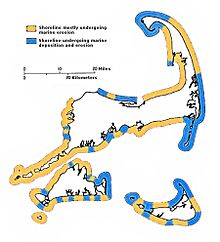 Coastal erosion by wave action (colored buff in this map) brings growth elsewhere by deposition of transported sediment (shown in blue). As the ice began to melt, the sea began to rise. Initially, sea level rose quickly, about 15 metres (49 ft) per 1,000 years, but then the rate declined. On Cape Cod, sea level rose roughly 3 metres (9.8 ft) per millennium between 6,000 and 2,000 years ago. After that, it continued to rise at about 1 metre (3.3 ft) per millennium. By 6,000 years ago, the sea level was high enough to start eroding the glacial deposits that the vanished continental ice sheet had left on Cape Cod. The water transported the eroded deposits north and south along the outer Cape's shoreline through a process known as longshore drift. Those reworked sediments that moved north went to the tip of Cape Cod. The entire town of Provincetown, at the extreme tip of the Cape, is a spit consisting largely of deposited marine sediment that was eroded and transported from farther south along the shore. Those sediments that instead moved south created the islands and shoals of Monomoy. So while other parts of the Cape have dwindled from the action of the waves, these parts of the Cape have grown through the deposition of sediment in just the last 6,000 years. This process continues today. Due to their exposure to the open ocean, the Cape and islands are subject to considerable coastal erosion. Geologists say that due to erosion, the Cape will be completely submerged by the sea within several thousand years.[19] This erosion causes the washout of beaches and the destruction of the barrier islands; for example, the ocean broke through the barrier island at Chatham during Hurricane Bob in 1991, allowing waves and storm surges to hit the coast with no obstruction. Consequently, the sediment and sand from the beaches is being washed away and deposited elsewhere. While this destroys land in some places, it creates land elsewhere, most noticeably in marshes where sediment is deposited by flowing water. Cape Cod's aquifer consists of six hydrologically independent lenses from which all the towns on the Cape obtain drinking water (except Falmouth, which, in 2015, drew 43.5% of its water from Long Pond).[20][21] Contamination with industrial chemicals and pharmaceutical drugs from septic systems is a concern.[22] Climate[edit] Although Cape Cod's weather[23] is typically more moderate than inland locations, on occasion it takes the brunt of extreme weather systems such as the Blizzard of 2005 and Hurricane Bob. Because of the influence of the Atlantic Ocean, temperatures are typically a few degrees lower in the summer and a few degrees higher in the winter than the adjacent mainland. A common misconception is that the climate is influenced largely by the warm Gulf Stream current; however, that current turns eastward off the coast of Virginia, and the waters off the Cape are more influenced by the cold Canadian Labrador Current. As a result, the ocean temperature rarely gets above 65 °F (18 °C), except along the shallow west coast of the Upper Cape and along the southern coast (Nantucket Sound), where water temperatures can sometimes reach 70 °F (21 °C) or higher. Cape Cod's climate is also known for a delayed spring season, being surrounded by an ocean which is still cold from the winter; however, it is also known for an exceptionally mild fall season (Indian summer), thanks to the ocean remaining warm from the summer. The highest temperature ever recorded on Cape Cod was 104 °F (40 °C) in Provincetown,[24] and the lowest temperature ever was −12 °F (−24 °C) in Barnstable.[25] The water surrounding Cape Cod moderates winter temperatures nearly enough to extend the humid subtropical climate zone to what could be its northernmost limit in eastern North America, as the majority of Cape Cod is in USDA hardiness zone 7a.[26] Consequently, many subtropical indicator plant species typically found in more southerly latitudes are grown there, including Camellias, Ilex opaca, Magnolia grandiflora and Albizia julibrissin. However, Cape Cod falls below the 72 °F (22 °C) threshold, as the warmest month, July, averages around 68.25 °F (20.14 °C). Therefore, the climate may be better characterized as either a maritime climate or a humid continental climate (particularly on the northern coast of the upper and mid cape, which is somewhat sheltered from the cooler onshore wind to the south). Precipitation on Cape Cod and the islands of Martha's Vineyard and Nantucket is the lowest in the New England region, averaging slightly less than 40 inches (100 cm) a year (most parts of New England average 42 to 46 inches (110 to 120 cm)). This is due to storm systems which move across western areas, building up in mountainous regions, and dissipating before reaching the coast where the land has leveled out. The region does not experience a greater number of sunny days, however, as the number of cloudy days is the same as inland locales, in addition to increased fog. On average, roughly 27 inches (69 cm) of snow, which is about 17 inches (43 cm) less than Boston, falls in an average winter. Once every five or six years, a tropical storm, accompanied by very high and potentially damaging winds and heavy rain, will strike the region. About once every 11 or 12 years a hurricanebrings damaging winds and storm surges to the region. Several Category 3 storms have struck Cape Cod since record-keeping began, such as a hurricane in 1869, the 1938 New England hurricane, and Hurricane Carol in 1954. Strong Category 2 storms, such as the 1869 Saxby Gale, Hurricane Edna in 1954, and Hurricane Bob in 1991, also caused considerable damage. Notable Category 1 storms include the 1944 Great Atlantic hurricane and Hurricane Donna in 1960. Other notable storms include the Gale of 1815, which would likely have been rated a strong hurricane on the Saffir-Simpson scale, and the so-called "Perfect Storm" of October 31, 1991. The February 2013 nor'easter produced winds in excess of 80 miles per hour (130 km/h) and dropped over 24 inches (61 cm) of snow on some parts of Cape Cod. The storm knocked out power to tens of thousands of Cape Cod residents, some for up to two weeks. Native population[edit] Cape Cod has been the home of the Wampanoag Native American people for many centuries. They survived off the sea and were accomplished farmers. They understood the principles of sustainable forest management, and were known to light controlled fires to keep the underbrush in check. They helped the Pilgrims, who arrived in the fall of 1620, survive at their new Plymouth Colony. The Wampanoag lost their lands through continued purchase and expropriation by the English colonists. The documentary Natives of the Narrowland (1993), narrated by actress Julie Harris, shows the history of the Wampanoag people through Cape Cod archaeological sites. In 1974, the Mashpee Wampanoag Tribal Council was formed to articulate the concerns of those with Native American ancestry. They petitioned the federal government |
|
kurtyang04 于 2018-11-01 05:45:02 编辑
|
|
 2018-11-01 06:06:47 2018-11-01 06:06:47
|
Post #15
Re: 沿着梭罗和足迹:鳕鱼角 海洋荒野户外文化瑰 ... |
 kurtyang04 kurtyang04
|
" 此地115 个沙滩,920公里海岸线(几乎都是沙滩), 属于世界最好的沙滩地区之一” 115 sandy beaches Cape Cod’s beaches are considered among the best in the world, especially those along the Cape Cod National Seashore, a 40-mile stretch of unspoiled sandy beach in Outer Cape Cod. With 559.6 miles of unspoiled coastline, Cape Cod offers many beautiful sandy beaches for you to enjoy. - See more at: http://www.capecodchamber.org/beaches#sthash.1j2QVSnI.dpuf |
 2018-11-01 06:09:41 2018-11-01 06:09:41
|
Post #16
Re: 沿着梭罗和足迹:鳕鱼角 海洋荒野户外文化瑰 ... |
 kurtyang04 kurtyang04
|
国家地理知识 堰洲島沙丘,湿地,海豹,鲸鱼 海洋舟北美特色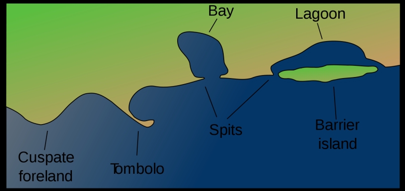 WIKI: 堰洲岛是沿海地貌,通过平行于大陆沿海的波浪和潮汐作用形成的极其平坦或者是沙的块状区域的一种沙丘带。 它们通常以链状形式存在,几个岛屿到十几岛屿组成。 它们受风暴和其他作用而改变,但吸收能量,保护海岸线和营造被保护的水域,使湿地在这里得以发展。堰洲岛链可以延伸不间断超过一百公里,除了分隔岛的潮口,最长最宽的堰洲岛链是德克萨斯州帕诸岛。 [1]堰洲的长度和宽度以及堰洲海岸整体形态与一些因素有关,这些因素包括潮差 , 波浪能 , 沉积物补给 , 海平面趋势 ,以及基底控制 。 [2] 堰洲岛链可以沿着约百分之十三的世界海岸线找到。 [3]它们表现不同的场景,这表明它们可以形成和被保持在各种环境场景中。 许多理论已经给出解释它们的形成。 Barrier islands are coastal landforms and a type of dune system that are exceptionally flat or lumpy areas of sand that form by wave and tidal action parallel to the mainland coast. They usually occur in chains, consisting of anything from a few islands to more than a dozen. They are subject to change during storms and other action, but absorb energy and protect the coastlines and create areas of protected waters where wetlands may flourish. A barrier chain may extend uninterrupted for over a hundred kilometers, excepting the tidal inlets that separate the islands, the longest and widest being Padre Island of Texas.[1] The length and width of barriers and overall morphology of barrier coasts are related to parameters including tidal range, wave energy, sediment supply, sea-level trends, and basement controls.[2] Chains of barrier islands can be found along approximately thirteen percent of the world's coastlines.[3] They display different settings, suggesting that they can form and be maintained in a variety of environmental settings. Numerous theories have been given to explain their formation. |
邀请xuliang1215参加此活动