 2020-12-09 08:25:37 2020-12-09 08:25:37
|
Post #1
美国落基山湖泊河流 五星级短途徒步 荒野露营路线研究 --- 户外旅行深度探险系列之二 |
 kurtyang04 kurtyang04

|
美国落基山湖泊河流 五星级短途徒步 荒野露营路线研究 --- 户外旅行深度探险系列之二美国落基山湖泊河流 的五星级短途徒步 荒野露营路线研究 笔记 --- 美国户外旅行深度探险系列之二 |
|
2020-12-09 08:52:00
|
Post #2
Re: 美国落基山湖泊河流 五星级短途徒步 荒野露营路线研究 - ... |
|
kurtyang04
|
5 Best Hikes in Flaming Gorge https://www.flaminggorgecountry.com/best-hikes |
|
2020-12-12 08:54:11
|
Post #3
Re: 美国落基山湖泊河流 五星级短途徒步 荒野露营 ... |
|
kurtyang04
|
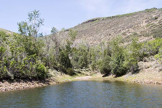
1 加里森河 ---Curecanti National Recreation Area
|
|
2020-12-12 08:56:43
|
Post #4
Re: 美国落基山湖泊河流 五星级短途徒步 荒野露营路线研究 - ... |
|
kurtyang04
|
BLUE MESA RESERVOIRTwenty mile long Blue Mesa Reservoir, with its 96 miles of shoreline, affords many opportunities for boating. MORROW POINT RESERVOIRFor the more adventurous and very hearty, Morrow Point Reservoir can provide a fabulous canoeing or sea kayaking trip. The adventure begins with hauling your boat and gear into the canyon. The easiest access to the reservoir is via the Pine Creek Trail. This trail consists of approximately 232 steps into the canyon. From the bottom of the stairs, the trail follows the reservoir for about a mile. You can put your boat in a short distance past the end of the stairs. 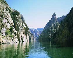 NPS photo by Lisa Lynch Morrow Point Reservoir is almost twelve miles long. The first half-mile of water is swift, but then becomes calm and still. Be aware that fluctuating water levels and releases from Blue Mesa Dam can suddenly create very challenging boating conditions.There are boat-in/backcountry campsites in the canyon, so you can make this an overnight outing. At the end of your trip, head back to the Pine Creek Trail to exit the canyon. The current may make it difficult to paddle back to the base of the stairs, but you can easily make it to the bottom of the stairs via the foot trail. Now comes the hard part, hauling your boat and gear back up the stairs! 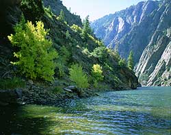 NPS Photo by Lisa Lynch CRYSTAL RESERVOIRLike Morrow Point Reservoir, boating on Crystal Reservoir is limited to hand carried craft. The access trail for Crystal Reservoir is reached via the Mesa Creek Trail located near Cimarron. Fluctuating water levels and releases from Morrow Point Dam can create navigational problems. Tricky currents, protruding rocks, and backwashes caused by water rushing over submerged rocks, can overturn the inattentive boater. In addition, conditions along the river section on Crystal can change drastically during the course of a day. Heavy spring runoff from Cimarron and Mesa Creeks can further complicate matters. Before launching, be sure to assess the capabilities of your equipment and the condition of the water. |
|
2020-12-12 09:08:31
|
Post #5
Re: 美国落基山湖泊河流 五星级短途徒步 荒野露营路线研究 - ... |
|
kurtyang04
|
BLUE MESA RESERVOIR TURTLE ROCKThis site is especially popular with people in canoes and other hand-carried craft due to the close proximity to Elk Creek. Photo » Distance: 10 minutes east of Elk Creek Marina Sites: 3 Vault toilets: yes Tables/fire grates: yes Fee: Free CEBOLLASurrounded by cottonwood trees, Gambel oak, juniper, sagebrush, tree snags and rocky cliffs. Photo » Distance: 1 hour from either marina Sites: 2 Vault toilets: yes Tables/fire grates: yes Fee: Free WEST ELKLocated next to the inlet of West Elk Creek, where remnants of sawmill and homesteading operations still stand. It is recommended that campers moor their boats on the west shore just before the bottleneck at the creek to avoid submerged timber. A trail leads to the campsites from this point. Photo » Distance: 1 hour from either marina Sites: 2 Vault toilets: yes Tables/fire grates: yes Fee: Free LAKE FORKThis site is located near a secluded cove and is shaded by spruce and fir trees. Distance: 30 minutes southeast of Lake Fork Marina Sites: 2 Vault toilets: yes Tables/fire grates: yes Fee: Free BLUE MESA BACKCOUNTRY LOCATIONSCamping is permitted along the south shore of Blue Mesa Reservoir, and on Red Creek Island, except within a half-mile of any developed area, bridge, maintained public road or other boat-in/backcountry campsite. View Park Map |
|
2020-12-12 09:08:51
|
Post #6
Re: 美国落基山湖泊河流 五星级短途徒步 荒野露营路线研究 - ... |
|
kurtyang04
|
MORROW POINT RESERVOIR Hand-carried craft only. Accessed via the Pine Creek Trail, which has 232 stairs. Sudden releases from Blue Mesa Dam may create hazardous boating conditions. Backcountry Use Permits For Morrow Point Reservoir Boaters are required to fill out a free backcountry use permit. Permits are available at the Pine Creek trailhead. CURECANTI CREEKThis site is surrounded by steep cliffs at the bottom of the Curecanti Creek Trail, just north of the Curecanti Needle. Photo » Sites: 1 Vault toilets: yes Tables/fire grates: no Fee: Free HERMIT'S RESTThis site is at the bottom of the Hermit's Rest Trail, approximately 1 mile east of Morrow Point Dam. Photo » Sites: 1 Vault toilets: yes Tables/fire grates: no Fee: Free MORROW POINT BACKCOUNTRY LOCATIONS Four primitive sites exist for boat-in campers on Morrow Point Reservoir. No amenities exist at these sites. Please see the map below for approximate locations. Map: Morrow Point and Crystal Reservoirs Backcountry/Boat-in Campsites » Detail of Morrow & Crystal Reservoirs showing available backcountry and boat-in sites (319k pdf). CRYSTAL RESERVOIRHand-carried craft only. Accessed at the Mesa Creek Trail trailhead at Cimarron immediately west of Morrow Point Dam. Sudden releases from Morrow Point Dam may create hazardous boating conditions. CRYSTAL CREEKThe campsite is in a secluded cove at the mouth of Crystal Creek, approximately 4 miles from the put-in. Sites: 1 Vault toilets: yes Tables/fire grates: no Fee: Free |
|
2020-12-12 09:21:20
|
Post #7
Re: 美国落基山湖泊河流 五星级短途徒步 荒野露营路线研究 - ... |
|
kurtyang04
|
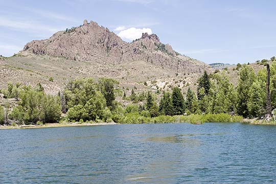
短途徒步 都是围绕水和石塔 Hermits Rest Curecanti Creek Dillon Pinnacle |
|
2020-12-12 09:54:54
|
Post #8
Re: 美国落基山湖泊河流 五星级短途徒步 荒野露营路线研究 - ... |
|
kurtyang04
|
2 加里森河 上游 Lower Slate River The Slate River winds through Crested Butte, and has become a favorite for paddleboarding and floating. The Lower Slate offers a more mellow float, and runs from in town near the Rec Path to Skyland. It’s important to remember that a lot of the land that runs along the river is private land or critical wildlife habitat. Only use designated put ins and take outs, and don’t leave the river mid float. Long Lake Long Lake (or Meridian Lake) is a gorgeous place to paddle just outside Crested Butte. For this destination, you have to pack up your paddleboard in a hiking pack, and make the short but steep hike up to the lake. This is a great place to see wildflowers in July, and a local favorite swimming spot! |
|
2020-12-12 09:55:35
|
Post #9
Re: 美国落基山湖泊河流 五星级短途徒步 荒野露营路线研究 - ... |
|
kurtyang04
|
Taylor River Class I-III(IV) The Taylor River is one of the classic boating rivers of Colorado, but is often overlooked because of its spectacular fishing and similarity to the Arkansas River to the east. The Upper Taylor sections offer fantastic intermediate Class III boating while the Lower Taylor is a beginner’s dream with miles of Class I-II. Since the Taylor is dam controlled you can expect to find boatable flows from mid-May through September. 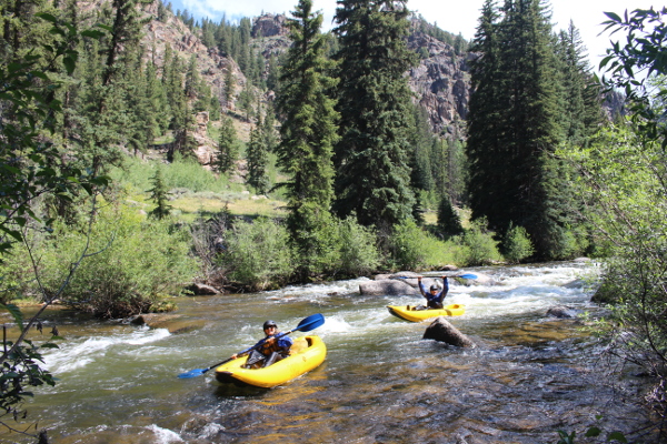 The Upper Taylor is a commercial rafting run that is great for adventurous families. Scenic River Tours and Three Rivers Resort both run trips on this splashy Class III section during the summer. The typical rafting trip on Upper Taylor runs 5 miles from Initiation to South Bank takeout. For the intrepid boater several other put-ins can be used. Above the Initiation put-in is a popular put-in called New Generation that allows boaters to run the only Class IV on the Taylor, Todd’s Slot. Another put-in just downstream from Lottis Creek Campground can make the Upper Taylor a 12 mile Class II-IV run. Be very careful of shifting wood, especially as the flows crank up during the early summer. The Upper Taylor is best from 300-1000 cfs on the USGS Taylor River at Almont gauge. Above 1000cfs the river is very continuous and is Class IV in character throughout. Be aware that at high water a low bridge can be hard to get under in the Lottis Campground to New Generation section. The Middle Taylor is Class II-III, but is not as often run due to private property issues along the river. This section is often run from South Bank (the Upper Taylor take-out) to Five-Mile Bridge. Both spots have great parking lots with bathroom and changing facilities. The runnable levels for the Middle Taylor are the same as the Upper Taylor, but be aware of low bridges as flows rise above 1000 cfs. |
|
2020-12-12 09:56:26
|
Post #10
Re: 美国落基山湖泊河流 五星级短途徒步 荒野露营路线研究 - ... |
|
kurtyang04
|
The Lower Taylor is a classic beginner run for those learning to kayak and canoe in the Gunnison Valley. This section of whitewater is also commercially rafted, and is a great alternative to the Upper Taylor for families that want a low-stress and splashy float. This section of the Taylor provides loads of Class I and II with plenty of take-out options and looming granite walls making for an aesthetic piece of whitewater. Most people put in at Five Mile Bridge, but any of the public access points downstream of this will suffice. The take-out is at the confluence of the Taylor and East Rivers in Almont. The minimum level for this section is 300 cfs on the USGS Taylor River at Almont Gauge. The Gunnison River and Gunnison Whitewater Park The Gunnison River is a section that is known more for its fishing than its whitewater boating, but that shouldn’t stop you from checking out another great section of whitewater. The Gunnison River is generally very family-friendly and several of the outfitters run rafting trips down the miles of easy Class I and II. One of the most popular trips is the rafting and dinner trip that runs from Almont to Garlic Mike’s in Gunnison throughout the summer. The Gunnison River is generally divided into two sections. The top section is the easier of the two and runs from Almont to North Bridge just before the city of Gunnison on Highway 135. This section features continuous moving water and some splashy Class I and II rapids with great fishing. The bottom section runs from North Bridge to Riverway Picnic Area. Riverway is also known as McCabe’s Landing to most locals. This section is very much like the first with the exception of the short section through the Gunnison Whitewater Park. Here man-made whitewater features are designed to be a little larger than the natural rapids of the Gunnison. If you’re on a SUP or in a kayak, hang out and play awhile. Nice eddies make easy returns to the surf waves. Once you’ve made it through the Park’s three drops don’t let your guard down because Psychedelic Falls lies downstream and care must be taken to run the right slot through the rapid. 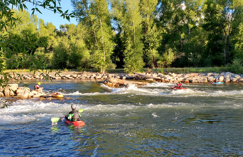
|
|
2020-12-12 10:08:17
|
Post #11
Re: 美国落基山湖泊河流 五星级短途徒步 荒野露营路线研究 - ... |
|
kurtyang04
|
Slate River The Slate River starts as a challenging whitewater creek before reaching the valley bottom near Oh-Be-Joyful Campground. From here to the bridge at Brush Creek Rd. the river mellows out and winds it’s way through willows and gravel bars for several miles. It is imperative that you check the water levels. Flows above 400 cfs should be considered high. Put in points for this stretch are the Oh-Be-Joyful Campground, Gunsight Bridge, and the Crested Butte Rec Path Bridge. You can take out at the Crested Butte Rec Path bridge or at the CO-135 bridge near Brush Creek Rd. No dogs are allowed on the Rec Path to CO-135 section at anytime, and are a bad idea in general on any SUP trip. There is a voluntary no-float period on the upper Slate River section from Gunsight Bridge to the Rec Path takeout from March 15 to July 15, 2019. This voluntary no-float period was proposed and enacted by local stakeholder decision in order to protect a blue heron rookery and private landowner relations on this section. Future boating on the Slate River depends heavily on good behavior from all floaters. Please consult this guide to learn about access, the no-float period, and other good river etiquette to make sure you’re helping and not hurting future access to this stretch of river. Lower Gunnison This stretch of river is a little bit more difficult, but there is less maneuvering since the volume of water is much higher. The most popular stretch to SUP is from North Bridge to the Whitewater Park. North Bridge is located north of Gunnison CO-135 across from Garlic Mike’s. The Whitewater Park is on US 50 West just past the turn for Hartman Rocks. A few spots in this stretch are easy Class 2. The Whitewater Park, if you choose to run it, is difficult Class 2. Once again, check the river level. Flows above 1,500 cfs are probably too high for most people. The Gunnison rarely gets too low to run. 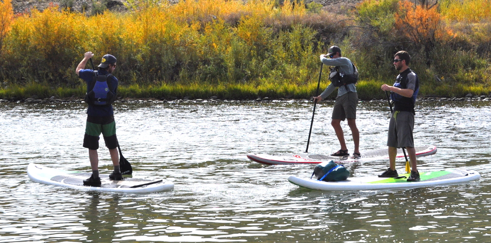
|
|
2020-12-12 10:09:48
|
Post #12
Re: 美国落基山湖泊河流 五星级短途徒步 荒野露营路线研究 - ... |
|
kurtyang04
|
Dispersed Camping Dispersed camp sites are a different ballgame altogether. Drive up almost any forest service road in the area and you will find people and campsites down little side roads. Some are hidden and tucked away, some are in large meadows of wildflowers, and some take a little clearance and good luck to get into. Except for Gothic/Schofield Pass Rd. (FSR 317), Taylor Canyon Rd. (CR 742) and around Tincup every other drainage offers some sort of dispersed camping option. 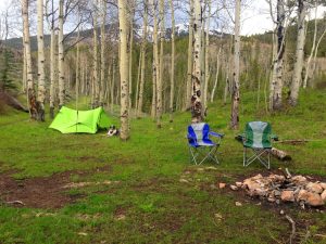 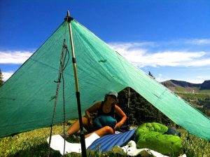 Dispersed camping is a privilege in this valley and deserves a little thought and care before you go charging off the beaten path (see above). Leave No Trace principles are important in order to leave sites in good order for the next visitors. |
|
2020-12-12 10:15:29
|
Post #13
Re: 美国落基山湖泊河流 五星级短途徒步 荒野露营路线研究 - ... |
|
kurtyang04
|
Gunnison Forks to Escalante Creek ~ 20 Miles     A little-traveled reach of the Gunnison River is the 20 miles between Gunnison Forks through Austin and Delta to Escalante Creek, a Class I to III- run on a basically flatwater stream with a shallow gradient of about 15 fpm. The run starts at an elevation of about 5,100 feet msl, then drops 300 feet over its course. This section leaves behind the deep canyons of Gunny Gorge and the tributary steep creeks where hairboaters go to play, offering instead a more leisurely run that is well suited for just about anybody in a raft, and canoeists and kayakers with intermediate or higher level whitewater skills, many of whom come here to hone their abilities for more formidable runs upriver or on other waterways. It is also a good place to tone paddling muscles that have been dormant over the winter months. The Town of Delta is about midway through this run, and provides an excellent intermediate location for access, food and beverages. Colorado SH 92 closely parallels the river above Delta, and US Highway 50 closely parallels the river from Delta to Grand Junction. This high desert run cuts through an area of red rocks and near wilderness as the river begins its descent to its confluence with the Colorado River at Grand Junction about 50 miles northwest of Delta. Within a few miles in either direction are the Black Canyon of the Gunnison River to the southeast, Gunnison National Forest to the east, Grand Mesa National Forest to the north, the Uncompahgre Plateau to the west and the Uncompahgre National Forest to the west-southwest. For those wanting a day on the river with a few exciting rapids and no death-defying hazards the run from Gunnison Forks to Escalante Creek is an excellent trip. Bring your camera!  Southcentral Delta County, beginning where the North Fork meets the mainstram of the Gunnison River east of Delta, about 60 miles southeast of Grand Junction.  Durango 138 miles; Grand Junction 60 miles; Denver 250 miles; Salt Lake City 345 miles; Albuquerque 350 miles; Phoenix 592 miles; Oklahoma City 875 miles; Dallas 1,034 miles; Austin 1,053 miles; San Antonio 961 miles; Houston 1,203 miles; Little Rock 1,191 miles; Kansas City 856 miles (all distances are approximate and depend upon starting point, destination point on the river and route taken.)  Water quality is generally good to very good, flowing clean, clear and cool to cold, depending upon season. Flow is usually steady, but moderate from late-spring through summer months, depending upon dam releases many miles upriver.  April through June, and possibly July are customarily the optimal months, depending upon conditions at Crystal Reservoir and the other lakes upstream.  This reach of the Gunnison River is usually hazard-free for competent paddlers. Occasional boulder garden rapids in the Class I to III- range will provide a small challenge and some excitement, but most are not particularly technical and can be run by novice paddlers in rafts with little or no difficulty. The shallow gradient and slower current make this run generally safe for most boaters most of the time.  Gunnison River Pleasure Park about 1 mile south of SH 92 between Austin and Hotchkiss at 0.0 miles; 2200 Road bridge at Austin at about 7.0 miles; SH 92/US Highway 50 at Delta at about 10.0 miles; Escalante bridge about 3 miles south of US Highway 50 at about 20.0 miles.  Gunnison River Pleasure Park, at the Gunnison Forks access, offers tent camping facilities. There are no other campgrounds located along this reach of the Gunnison River. Nearby camping is available at Sweitzer Lake State Recreation Area off US Highway 50 just southeast of Delta, Crawford Reservoir State Recreation Area off SH 92 about 11 miles south of Hotchkiss and at several other excellent campgrounds in the area of Grand Mesa National Forest off either side of SH 65 about 20-30 miles north of Delta and Austin. Other campgrounds may be available in the near vicinity, though most will be a couple of hours away by car.  Numerous commercial outfitters offer rentals, shuttles, guided trips and river information on the Gunnison River.  The Gunnison Forks to Escalante reach of 20 miles is an interesting and not-too-challenging run on moderately moving flatwater with a few Class I to III- rapids that most boaters can enjoy without risking life and limb. This late-spring through mid-summer run is well-suited for paddlers in canoes, kayaks and rafts, offering possible intermediate distances of 3, 7 or 10 miles with easy access, depending upon where you start and stop. The area is scenic, but the big canyons are above this reach, and the river mellows as it heads toward its rendezvous with the Colorado River at Grand Junction about 60 miles below the Gunnison Forks access. Escalante Creek enters the river where this run ends, unless you want to continue downriver another 26 miles to Whitewater or on down to Grand Junction. If you are hairy enough, the the Class V Escalante Creek run of 6.5 miles might be worth your while, but if that is your cup of tea, then you probably will not be paddling this section of the Gunnison River. This leisurely trip is quite enjoyable when it flows, and offers great photographic opportunities, so bring your camera and capture some of those "Kodak moments" that you will treasure and share for the rest of your life. |
|
2020-12-13 08:55:10
|
Post #14
Re: 美国落基山湖泊河流 五星级短途徒步 荒野露营路线研究 - ... |
|
kurtyang04
|
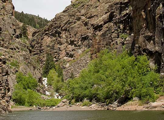
加里森预留 1 |
|
2020-12-13 08:55:33
|
Post #15
Re: 美国落基山湖泊河流 五星级短途徒步 荒野露营路线研究 - ... |
|
kurtyang04
|
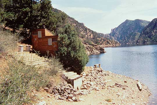
加里森预留 2 |
|
2020-12-13 10:03:52
|
Post #16
Re: 美国落基山湖泊河流 五星级短途徒步 荒野露营 ... |
|
kurtyang04
|
加里森预留 41 |
|
2020-12-13 10:04:09
|
Post #17
Re: 美国落基山湖泊河流 五星级短途徒步 荒野露营 ... |
|
kurtyang04
|
加里森预留 3 |
|
2020-12-13 10:04:34
|
Post #18
Re: 美国落基山湖泊河流 五星级短途徒步 荒野露营 ... |
|
kurtyang04
|
加里森预留 5 |
|
2020-12-13 10:11:01
|
Post #19
Re: 美国落基山湖泊河流 五星级短途徒步 荒野露营路线研究 - ... |
|
kurtyang04
|
加里森预留 1 |
邀请xuliang1215参加此活动

 分享
分享
